Route PlannerENMS

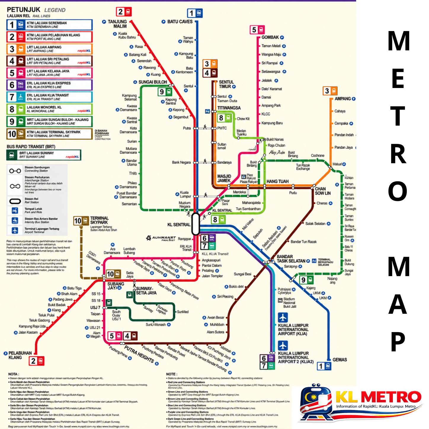
Map of KL Metro

Map of the Rapid KL urban rail network in the Klang Valley: LRT, MRT and KL Monorail lines, with interchange stations. Download the map below.

Information updated: November 2026

The KL Metro network

Klang Valley Integrated Transit Network map — Rapid KL LRT, MRT, Monorail, KTM Komuter, ERL and BRT

Klang Valley Integrated Transit Network map. Independent, unofficial — always check the official channels for current alignments and service changes.

KL Metro map in PDF — download

Download the network map as a PDF — full quality when printed, works offline, and keeps every line and station at hand.

Lines

Gombak ↔ Putra Heights
37 stations · ~98 min
Sentul Timur ↔ Ampang
18 stations · ~28 min
Sentul Timur ↔ Putra Heights
29 stations · ~60 min
Kwasa Damansara ↔ Kajang
29 stations · ~88 min
Kwasa Damansara ↔ Putrajaya Sentral
36 stations · ~68 min
KL Sentral ↔ Titiwangsa
11 stations · ~26 min
Bandar Utama ↔ Johan Setia
20 stations · ~66 min

Contents